

Carnaween [Carn na nEan]
Good walks are even better shared.
Overview
Carnaween [Carn na nEan]
Overview
Nestled amidst the captivating Donegal Mountains in Ireland, Carnaween stands proud at 665 meters above sea level. Known for its stunning vistas and rugged terrain, it's a beloved spot for hikers seeking both challenge and beauty.
Geology
Carnaween is primarily composed of solid granite, interspersed with schist and quartzite rock formations. These geological wonders tell tales of ancient volcanic activity and glacial sculpting. If you fancy yourself a geology aficionado, keep your eyes peeled for interesting rock patterns that seem to tell the Earth’s story.
Routes
There are several routes to conquer Carnaween, each offering unique challenges and perspectives:
- Western Approach from the Upper Glen: A manageable 6.5 km route that accommodates walkers of varying experience, offering picturesque scenery along the way and taking approximately 2.5 hours.
- Northern Ridge Route: For those seeking a bit more of a test, this challenging 4 km ascent includes some steep sections. Be prepared for around 3.5 hours of exhilarating effort.
Summit Features
At the summit, you'll find a substantial stone cairn, a perfect spot for a moment of reflection or a triumphant pose. Plus, the feeling of standing on top of the world (or at least Donegal) is unbeatable!
Terrain
Expect a mix of rocky challenges and lush grassy patches, with the occasional boggy area that could turn your boots into sponges. Suitable footwear is recommended to keep you on your feet.
Views
The views from Carnaween are nothing short of spectacular. On a clear day, the panoramic sight includes the rugged beauty of the Donegal coastline, the nearby Bluestack Mountains, and even a glimpse of Northern Ireland’s hills. For the best experiences, try hiking here in spring or autumn when the views are particularly vivid.
Hazards
Keep an eye on the weather, as it tends to change faster than you can say 'top of the mountain.' The rocky paths can be tricky, especially when muddy, so steady yourself well.
Access
Getting to Carnaween is quite straightforward, with parking available near the upper Glen Road. However, it can fill up quickly, so arrive early if you want to avoid the circus!
Facilities
After conquering the mountain, return to Donegal town, where you’ll find various cafés and pubs to refuel. There you can indulge in a well-deserved treat or two.
History
The name 'Carn na nEan' translates to 'the heap of the birds,' evoking images of majestic birds soaring overhead and the area's rich avian life. Beyond its natural beauty, Carnaween also holds cultural significance, having guided local communities for generations.
Final Words
In essence, Carnaween is not just a hike; it’s an adventure wrapped in history and geology, with lush landscapes and captivating views that simply should not be missed. Grab your gear, lace up your boots, and head for the hills!
Happy hiking!
Explore routes near Carnaween [Carn na nEan]
Public walks starting within 80 km of this hill. Nearby does not mean a route reaches the summit; check its map and access before setting out.
Florence Court: Riverside and Forest Circuit, County Fermanagh
View route
Derry~Londonderry City Walls Circuit
View route
Route planning notes
These notes describe possible approaches, not verified navigable routes or permission to cross land. Check current paths, local access rules and conditions before setting out.
Western Approach from the Upper Glen
A well-trodden path starting from the upper Glen area. This route offers gentle ascent through scenic landscapes.
Northern Ridge Route
A more challenging ascent via the northern ridge, with some steep sections that reward climbers with breathtaking views.
Make a day of it, together
Find someone to share the walk with, or organise a day out along a route you like.
Photo Gallery
View all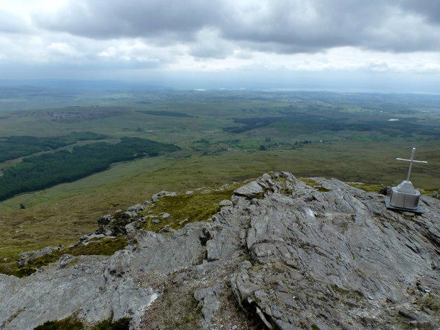 Photo could not load
G8789 : Top of Carnaween Mountain
louise price
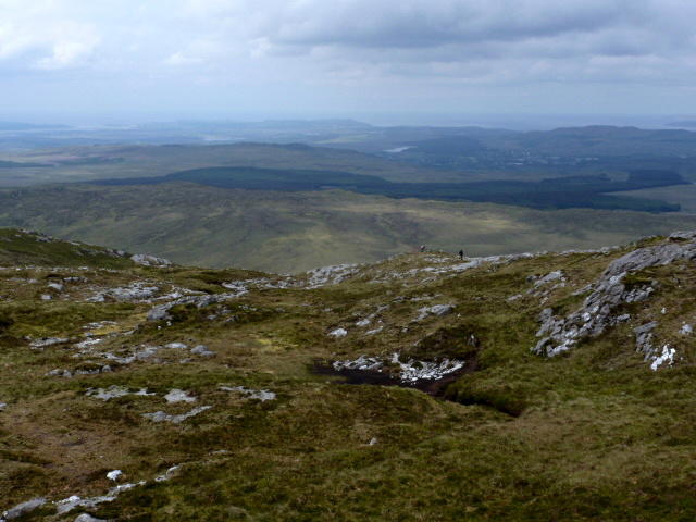 Photo could not load
G8789 : North shoulder of Carnaween
louise price
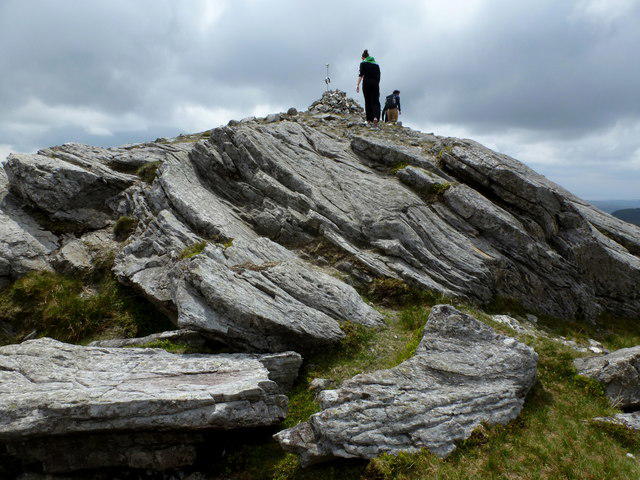 Photo could not load
G8789 : Carn na nÉan or Carnaween summit
louise price
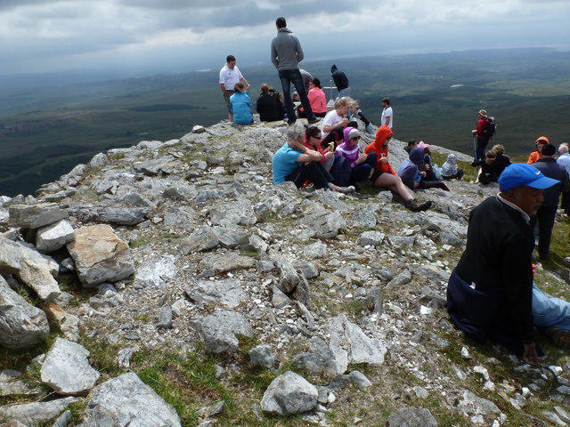 Photo could not load
G8789 : Busy day on Carnaween
louise price
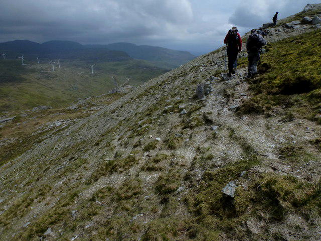 Photo could not load
G8789 : Climb to Carnaween
louise price
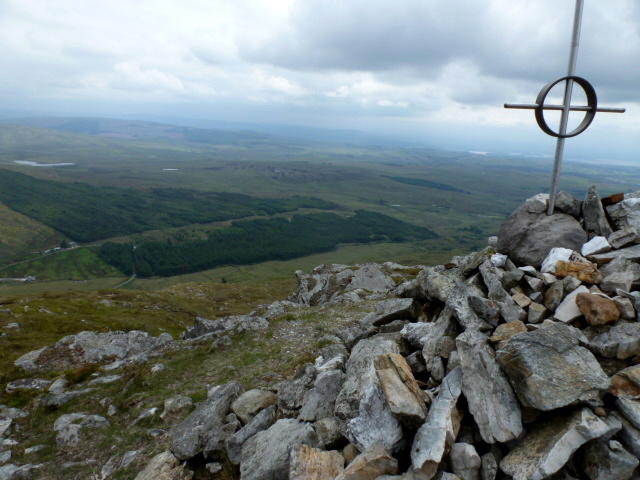 Photo could not load
G8789 : Carn na nÉan Summit
louise price
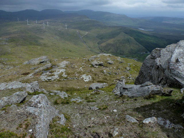 Photo could not load
G8789 : View from Carnaween
louise price
Hill facts and local notes
Classifications
Elevation
521m
1,709 ft
Prominence
166m
Coordinates
54.7497, -8.1933
G876891
OS Map
11
At the Summit
The summit is marked by a prominent cairn, which makes a great spot for a selfie or just pretending to be a mountain goat surveying its kingdom.
Terrain & Geology
Carnaween is primarily composed of granite, with some areas showcasing schist and quartzite. The mountain's rocky outcrops provide an excellent opportunity for geology enthusiasts to examine the unique formations and the effects of glacial erosion.
Views & Scenery
From the summit, one can see the rugged Donegal coastline, the Bluestack Mountains, and, on a clear day, even the distant hills of Northern Ireland.
History & Heritage
Name Origin
In Irish, 'Carn na nEan' translates to 'the heap of the birds,' which could either refer to the numerous birds seen at the summit or the fact that it's a favourite among birdwatchers.
Historical Significance
Historically, Carnaween has been a prominent landmark for local communities, guiding them through both terrain and folklore.
Getting There & Facilities
Check current local access restrictions, parking rules and transport timetables before travelling. These notes do not confirm public access to the summit.
Parking
There is a designated car park near the upper Glen Road, approximately 1 km from the trailhead. It’s a tight squeeze during busy weekends, so arrive early!
Public Transport
The nearest bus service runs from Donegal town to the village of Glencolumbkille, followed by a 6 km walk to the trailhead.
Nearby Facilities
There are several small cafes and pubs in the town of Donegal, offering refreshments and the all-important facilities to recharge before or after your hike.
Safety Information
Known Hazards
- Sudden weather changes can occur, so it's wise to pack a waterproof jacket. Watch your step on the rocky paths; a tumble could leave you with more than just bruised pride!
General Safety Tips
- Check weather conditions before setting out
- Carry appropriate clothing and equipment
- Let someone know your planned route
- Take a map, compass, and GPS device
- Carry emergency supplies: food, water, first aid kit, torch
Hills
Some common questions about the hills answered
Are there group walks up Carnaween [Carn na nEan]?
Many walkers use Walkmates to join or organise walks with others. You can check for group walks around Carnaween [Carn na nEan] through the maps
Are there other walkers around Carnaween [Carn na nEan]?
Activity varies by location and time, but Walkmates lets you see whether others have shared walks or shown interest in this area. Find other people through the walking friends search walking friends for Carnaween [Carn na nEan] search or of course create your own walk for Carnaween [Carn na nEan]
Can I organise a walk to Carnaween [Carn na nEan]?
Yes. If there aren’t any walks listed already, you can create a walk and make it available for others to join.
If you're signed up to Walkmates, you can create a walk to Carnaween [Carn na nEan].
How do I find a walk up this hill?
There are often multiple ways to walk this hill, depending on experience and route preference. Walkmates helps you explore walks and routes that others have shared.
Can I suggest a new route up Carnaween [Carn na nEan]?
Yes. You can suggest or create routes to share with others. Walkmates focuses on the social side of walking, so routes are used to help people organise walks and explore areas together, rather than as detailed navigation tools or route libraries.
Other uses really appreciate knowledgeable walkers sharing their routes. Share your favourite route to Carnaween [Carn na nEan] here
The is an error or something incorrect about this hill. How do I let you know?
We always strive to keep the information on Walkmates as accurate as possible. If you find an error, please let us know through the contact form and we'll aim to correct it as quickly as possible
Community Discussion
Comments
Location
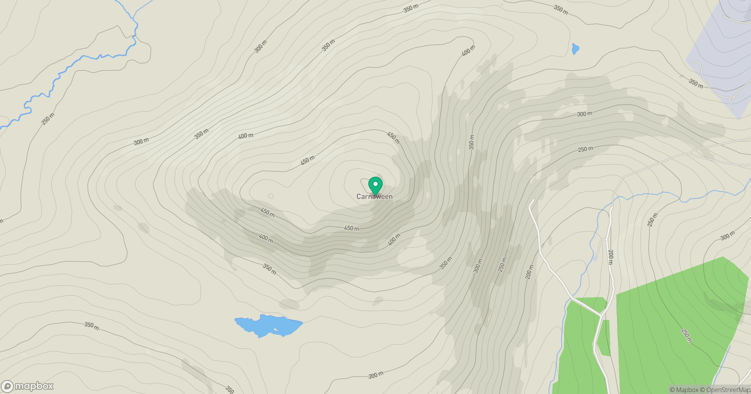
Grid reference: G876891
View on OpenStreetMapOpens a map in a new tab, centred on the hill.
Hills within 30 km
Straight-line distance, not a walking route or confirmation of access.
No comments yet. Be the first.